Summary
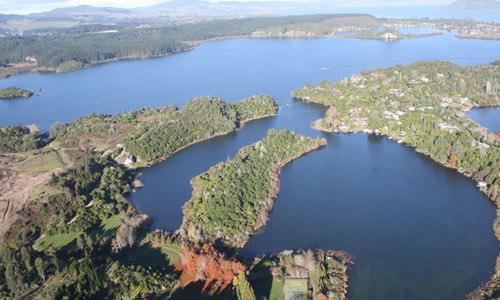
Lake Rotoma is located adjacent to SH30 near Lake Rotoehu. The lake has total area of 1110 ha and a catchment area of 2810 ha. The catchment comprises of native bush, live stock farming and areas of exotic plantation forests. The average depth of the lake is 37m and the deepest point of the lake is 83 metres.
Lake Rotoma is the cleanest of all the Rotorua lakes, with water clarity of around 11 metres. The clarity makes fly fishing more challenging. Four buoys near the centre of the lake mark a submerged Maori pa site. Lake Rotoma means "lake of exceptionally clear water". The lake currently has the best water quality of all the Rotorua lakes.
The 2015 TLI for Lake Rotomā was well above the target TLI due to a long hot summer. However, lake water quality needs to be considered by a rolling average rather than annually to get a true picture of water quality conditions. This is because annual readings can be influenced by one off climatic conditions. The 3 year rolling average TLI for Lake Rotomā is around is target of 2.3.
Ngati Pikiao claims this lake as part of their tribal rohe extending from Mourea in the west. Ngati Awa from the Mataatua canoe also claims the lake and surrounds as their rohe; and Ngati Tuwharetoa (Bay of Plenty) claim association with this area through Rakeimarama, Tuwharetoa’s matamua (eldest) son. These tribes have fought for occupation of this area from time to time.
An Action Plan is being implemented with the key action of sewerage reticulation. This sewerage reticulation is scheduled to be completed along with the remaining Lake Rotoiti reticulation in 2018-2019. However, there have been increasing phosphorous levels in the lake over recent years. The level of phosphorus that will be removed by reticulation is being evaluated and there is some science work required to determine whether some further marginal reduction in phosphorus will be required from land use.


